Climate change pushes on coastal and estuarine regions by a lot of pathways simultaneously, and it is surprisingly hard to untangle and prioritise these. As just one example from the US Pacific Northwest: should we expect future water temperatures to go up or down?
Up makes sense, because of atmospheric warming. Down also makes sense, because of the influence of coastal upwelling: some (but not all) model scenarios suggest that global warming will be accompanied by an acceleration of the coastal wind-driven upwelling syst
em, which draws deep, cold water through the Strait of Juan de Fuca into the Salish Sea. So which of these mechanisms wins out where?
The NOAA PS-AHAB (Puget Sound Alexandrium Harmful Algal Blooms) project recently took a look at this. Alexandrium, which produces potent neurotoxins that accumulate in shellfish, has been found to have a clear thermal niche in the Puget Sound region, and so looking at changes in water temperature in future model scenarios is one window into the question of how the prevalence of Alexandrium HABs (or the seasonal window of opportunity for Alexandrium HABs) is likely to change in future climate. You can read all about the Alexandrium story in Moore et al. 2015 (short answer: it’s a good bet to expect more Alex blooms).
We picked one global climate scenario to examine in detail (CCSM3-A1B); Eric Salathé ran the regional weather model WRF inside this global scenario, to generate a sort of statistical sample of present-day and 2040s weather over the Pacific Northwest; and then the UW Coastal Modeling Group ran a modified version of our Cascadia ocean model that was driven by the WRF downscaling. The short answer to the question posed above about future water temperature in Puget Sound looks like this:
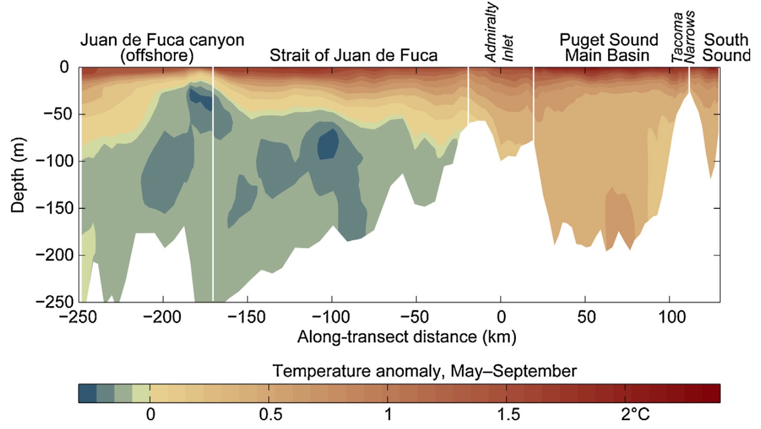
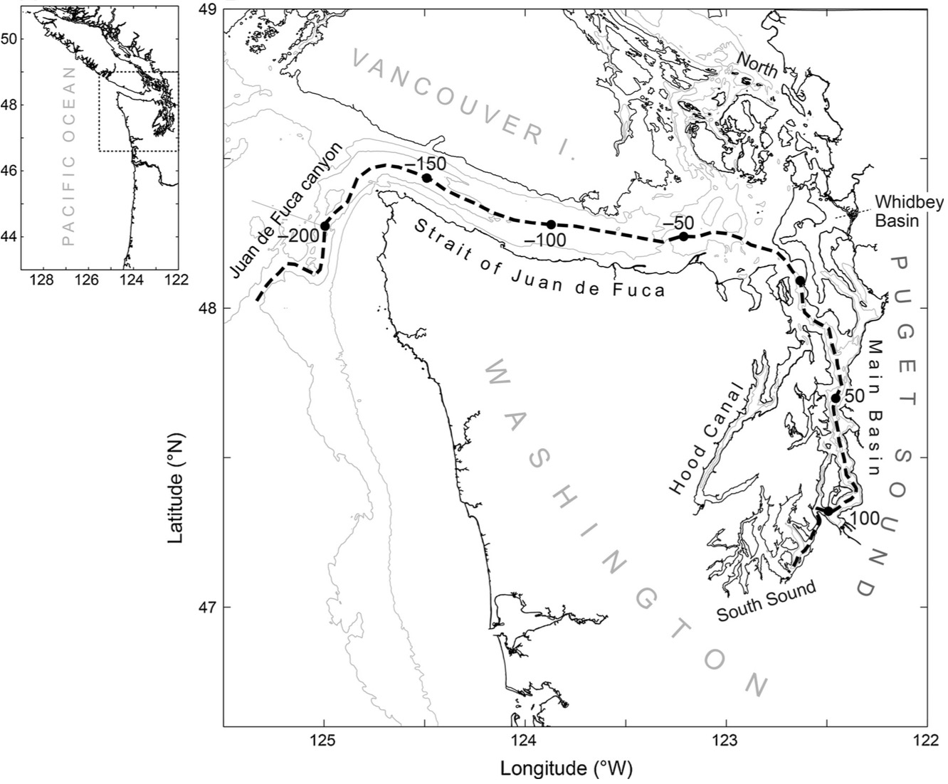
This figure shows the difference between 2040s and present-era summer temperatures along a transect down the main axis of the Strait of Juan de Fuca, Puget Sound Main Basin, and South Sound. The surface waters get warmer, to a degree similar to the projected change in surface air temperatures. A tongue of deep water entering the system from the outer coast gets slightly colder, because of intensified upwelling—although that signal doesn’t appear to make it (on average) past the tidal churning of Admiralty Inlet. See Moore et al. 2015 for further info.
That deep cooling is only a fraction of a degree Celsius (note the difference in positive/negative color scales), and so it doesn’t mean much in terms of thermal niches for estuarine organisms—but small differences in deep-water temperatures like this can indicate major differences in the chemistry of the incoming water, such as its nutrient load, oxygen level, or pH. A full biogeochemical model projection for Puget Sound remains a work in progress.