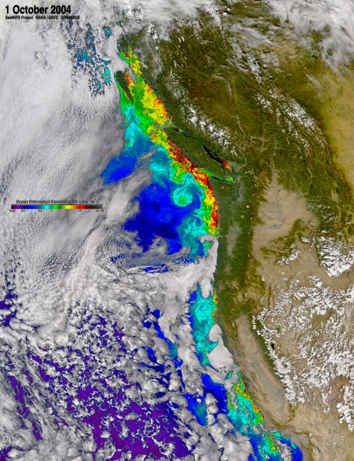
The Pacific Northwest coast is the most biologically productive region of the California Current upwelling system, despite the fact that the upwelling winds are much stronger farther south. How can this be?
In this paper…
Hickey BM, Banas NS (2008) Why is the northern end of the California Current System so productive? Oceanography, 21:90-107. (download pdf)
…Barbara Hickey and I laid out a number of partial answers. Coastal-trapped waves carry energy from the wind maximum to the south up the coast. Canyons amplify the effect of what local upwelling winds there are. Wide shelves and the dynamics of the Columbia River plume increase retention of nutrients and phytoplankton. And there was one further surprise: Barbara did a back-of-the-envelope calculation that suggested that a large fraction of the deep marine nutrients driving the region’s productivity were supplied to the surface layer not by wind-driven upwelling, but by estuarine circulation (i.e., river-driven processes) in the Strait of Juan de Fuca.
As part of the PNWTOX program, Kristen Davis used the UW CMG Cascadia model to explore this idea in greater detail. It appears that half the primary production on the Vancouver Island shelf and one third of the production on the Washington shelf can actually be attributed to this “estuary-enhanced upwelling” mechanism. The paper is here…
Davis KA, Banas NS, Giddings SN, Siedlecki S, MacCready P, Hickey BM, Lessard EJ, Kudela RM. Estuary-enhanced upwelling of marine nutrients fuels coastal productivity in the US Pacific Northwest. J Geophys Res, doi:10.1002/2014JC010248.
… and this work was featured in an AGU Research Spotlight here.
More recently, Hally Stone examined the role of large-scale advection in shaping the biogeochemistry of the PNW shelf and slope, compared with local processes and variability in upwelling (short version: advection is important):
Stone HB, Banas NS, MacCready P (2018) The effect of alongcoast advection on Pacific Northwest shelf and slope water properties in relation to upwelling variability. J. Geophys. Res., 123, 10.1002/2017JC013174.
Hally then went on to situate the PNW coast within large-scale patterns in another way: using satellite observations to evaluate the long-standing hypothesis that an intermediate level of upwelling-favourable wind yields the maximum phytoplankton biomass accumulation, as opposed to increasing with wind stress monotonically. In this paper…
Stone HB, Banas NS, MacCready P, Kudela RM, Ovall B (2020) Linking chlorophyll concentration and wind patterns using satellite data in the Central and Northern California Current System. Front Mar Res., 10.3389/fmars.2020.551562
… we found that this dome-shaped relationship between wind stress and chlorophyll does hold for the CCS as a whole, although it is usually not apparent at any one latitude over time. And—to return to our original mystery—the Northern CCS shows a different relationship between chlorophyll and wind than the Central and Southern CCS, with higher productivity at zero or weakly downwelling-favourable wind stress:
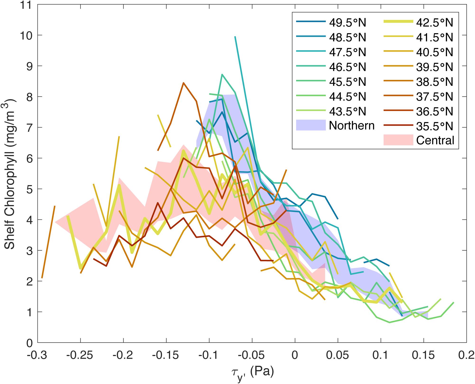
This probably is the signature of the effect of non-upwelling-derived nutrients that Hickey and Banas (2008) and Davis et al. (2015) described.
Currently I am interested in the possibility that the Washington-Oregon coast needs to be thought of as the southern end of the Coastal Gulf of Alaska, or even the extreme southern end of the Continguous Pan-Arctic Riverine Coastal Domain, as well as the northern end of the California Current System. If you have collaboration ideas on this topic, please get in touch.